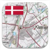
Denmark Topo Maps PC
ATLOGIS Geoinformatics GmbH & Co. KG
Download Denmark Topo Maps on PC With GameLoop Emulator
Denmark Topo Maps sa PC
Ang Denmark Topo Maps, na nagmumula sa developer na ATLOGIS Geoinformatics GmbH & Co. KG, ay tumatakbo sa Android systerm sa nakaraan.
Ngayon, maaari mong laruin ang Denmark Topo Maps sa PC gamit ang GameLoop nang maayos.
I-download ito sa GameLoop library o mga resulta ng paghahanap. Hindi na tumitingin sa baterya o nakakadismaya na mga tawag sa maling oras.
I-enjoy lang ang Denmark Topo Maps PC sa malaking screen nang libre!
Denmark Topo Maps Panimula
+++ OUR NEW GPS APP - Perfect for Denmark Trips +++
Easy to use Outdoor/Offline GPS navigation app with access to the best topographic maps and satellite images for Denmark.
++ For offline use PRO features needed ! ++
Turn your Andoid Phone/Tablet into an outdoor GPS for trips into the backcountry WITHOUT CELL COVERAGE. This app gives you similar mapping options as you might know from Garmin or Magellan GPS handhelds.
Included FREE map layers:
• Topographic Map 1:50.000 for Scandinavia ( Denmark, Norway, Sweden und Finland) with hillshading
• Topographic Map 1:25.000 for Denmark (DTK/Kort25)
• Denmark aerial imagery
• Denmark Basemap (DTK/Skaermkort)
• Historical Topo Maps of Denmark
• OpenStreetMaps : These crowdsourced maps are a very useful addition to other map layers. Contains many unique features.
• OpenCycleMaps: These maps are ideal to plan bicycle trips (PRO Users only !)
• ESRI Topographic
• ESRI Aerial Images
• ESRI Street Map
• Google Road Map (online access only)
• Google Satellite Images (online access only)
• Google Terrain Map (online access only)
• Bing Road Map (online access only)
• Bing Satellite Images (online access only)
• Earth At Night
• Hillshading overlay
Main features for outdoor-navigation:
• Create and edit Waypoints
• GoTo-Waypoint-Navigation
• Track Recording (with speed, elevation and accuracy profile)
• Tripmaster with fields for odometer, average speed, bearing, elevation, etc.
• GPX/KML/KMZ Export
• Search (placenames, POIs, streets)
• Customizable datafields in Map View and Tripmaster (e.g. Speed, Distance, Compass, ...)
• Share Waypoints, Tracks or Routes (via eMail, Whatsapp, Dropbox, Facebook, ..)
• Display coordinates in Lat/Lon, UTM or MGRS/USNG (Military Grid/ US National Grid)
• Record & share tracks with statistics & elevation profile
• Rotate map (Track Up & North Up)
• Get Elevation and Distance by long click on map
• Track Replay
• Add custom map tile servers
• and many more ...
Available Pro features: (Pro features available via In App Purchase)
• Offline Use - no cell coverage needed. No Roaming fees !
• Easy+Fast Bulk-download of map tiles for OFFLINE USAGE (not for Google and Bing maps)
• Create and edit Routes
• Route-Navigation (Point-to-Point Navigation)
• GPX/KML/KMZ Import/Export
• unlimited Waypoints & Tracks
• Add other Map Tile-Server
• No Ads
Offline Use:
All viewed map tiles are kept in cache. To cache large areas you need to purchase Pro features.
Use this navigation app for outdoor activities like hiking, biking, camping, climbing, riding, skiing, canoeing, hunting, offroad 4WD tours or search&rescue (SAR).
Add custom waypoints in longitude/latitude, UTM or MGRS/USNG format with WGS84 datum.
Import/Export/Share GPS-Waypoints/Tracks/Routes in GPX or Google Earth KML/KMZ format.
Preload FREE map data for areas without cell service (Pro feature !).
Comments and feature requests to denmarkmaps@atlogis.com
Have a look at our other outdoor navigation apps: https://play.google.com/store/search?q=atlogis
+++ We DO NOT track any user activities or collect any user data ! +++
Preview


Tags
Maps-&Information
Developer
ATLOGIS Geoinformatics GmbH & Co. KG
Latest Version
7.8.2
Last Updated
2025-07-03
Category
Maps-navigation
Available on
Google Play
Show More
How to play Denmark Topo Maps with GameLoop on PC
1. Download GameLoop from the official website, then run the exe file to install GameLoop
2. Open GameLoop and search for “Denmark Topo Maps” , find Denmark Topo Maps in the search results and click “Install”
3. Enjoy playing Denmark Topo Maps on GameLoop
Minimum requirements
OS
Windows 8.1 64-bit or Windows 10 64-bit
GPU
GTX 1050
CPU
i3-8300
Memory
8GB RAM
Storage
1GB available space
Recommended requirements
OS
Windows 8.1 64-bit or Windows 10 64-bit
GPU
GTX 1050
CPU
i3-9320
Memory
16GB RAM
Storage
1GB available space